Albermaine · The Covenant of Steel
The Pariah map of Albermaine
Explore Western Albermaine from Anthony Ryan’s The Pariah, the first book of The Covenant of Steel. Follow the western duchies and coast, then move closer to an interpreted Castle Ambris and its neighbouring town.
In this atlas
What you can explore
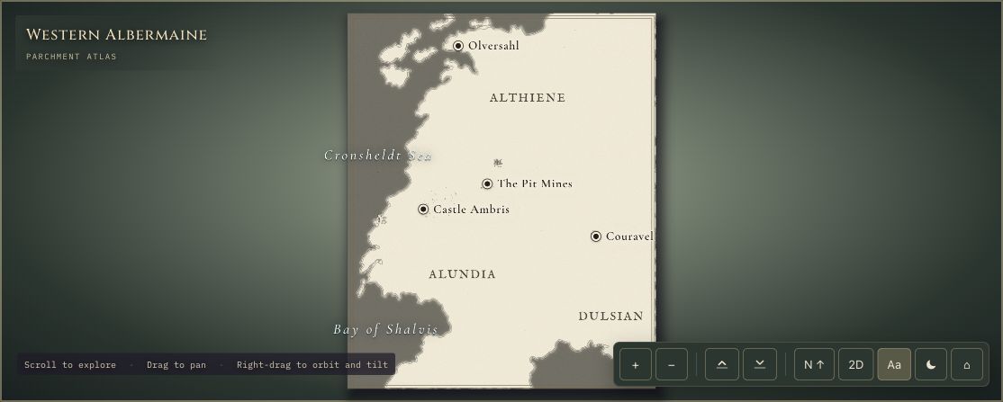
The overview covers Western Albermaine, with named places such as Couravel, Callintor, Farinsahl and the Pit Mines. The detailed Ambris scene shows the castle, moat, Leevin River and the town of Ambriside.
- Open Western Albermaine
The wider setting
Western Albermaine map
Explore the western duchies, coast and named settlements of the mapped realm.
- Open Castle Ambris
A closer view
Castle Ambris map
View the castle defences and an interpreted local setting with a moat, river and neighbouring town.
A route through the map
Begin with Western Albermaine to see the regional relationships. Switch to Castle Ambris for the local diorama. Buildings and terrain are easier to compare from above; tilt after zooming in to inspect the walls and rooftops.
Try these starting points:
Questions about this map
Which part of Albermaine does The Pariah map show?
The overview covers Western Albermaine, the setting mapped for Anthony Ryan’s The Pariah. It includes places such as Couravel, Callintor, Farinsahl and the Pit Mines. A separate Castle Ambris scene provides a closer local view.
Is this a map for The Covenant of Steel?
Yes. The Pariah is the first book of The Covenant of Steel, and this atlas focuses on its setting. It does not claim to show every location or change from The Martyr and The Traitor.
Where can I find the original published map?
Anthony Ryan’s Map Room provides the map from The Pariah for readers who need a clearer view outside the book. RuneCharted offers an interactive interpretation; the author’s original is linked below.
Geography and artistic interpretation
The regional geography is registered against the author’s The Pariah map. The local Ambris scene draws on the project’s text research for the castle, moat, river and town relationships. Castle plans, dimensions, internal buildings and incidental settlement layouts are original interpretations.
Read this map’s source and interpretation notes. The research notes may discuss later-book geography.
Before you explore: spoilers
The atlas presents the setting without staging plot outcomes. Named locations and an Alwyn Scribe cameo may be encountered before they appear in a reader’s current chapter.