Erilea · Throne of Glass
Throne of Glass map of Erilea
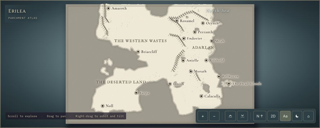
Explore Erilea from Sarah J. Maas’s Throne of Glass, then descend toward an imagined Rifthold. The continent overview connects forests, mountain chains and named places; the city scene brings the Glass Castle and surrounding rooftops closer.
In this atlas
What you can explore
Erilea is the mapped continent in this pack. The separate Rifthold scene is a local diorama with a glass skyline above stone streets and the Avery. Together they provide a continental view and a closer city interpretation.
- Open Erilea
The wider setting
Erilea map
Explore the continent’s geography, from forests and mountain chains to its named regions and settlements.
- Open Rifthold
A closer view
Rifthold map
Circle an imagined city skyline, the Glass Castle and the river setting from above.
A route through the map
Start with Erilea to place Rifthold within the wider continent, then open the city tab. Use the labels and overhead view to find the Glass Castle before orbiting and tilting for a closer view of its spires.
Try these starting points:
Questions about this map
Is Erilea the map used for Throne of Glass?
Erilea is the continent shown in this Throne of Glass atlas. The overview helps you place regions and settlements within the wider geography, while the Rifthold scene offers a closer interpretation of the city and Glass Castle.
Can I explore Rifthold and the Glass Castle?
Yes. Open Rifthold from the buttons above or the map tabs, then select the Glass Castle. The city layout and buildings are original interpretations; this is an aerial map, without walkable rooms or palace interiors.
Does this include the Southern Continent from Tower of Dawn?
No. The current pack covers Erilea and Rifthold. There is no separate Southern Continent atlas or chapter-by-chapter journey tracker. The series geography may show names that you have not encountered yet.
Geography and artistic interpretation
Erilea’s geography follows the project’s registration against the Bloomsbury map poster. Rifthold’s street plan, architectural compositions and character placement are artistic interpretations, rather than a published city plan. Forest and mountain relief is stylised for the interactive atlas.
Read this map’s source and interpretation notes. The research notes may discuss later-book geography.
Before you explore: spoilers
The pack shows geography from the series map without later-book plot outcomes. Place names and a character cameo can still appear before a reader encounters them in the story.