Roshar · The Way of Kings setting
Roshar map: The Stormlight Archive
Explore Roshar and the Shattered Plains from Brandon Sanderson’s The Stormlight Archive. The map starts with The Way of Kings setting, from storm-shaped coasts and sheltered cities to the ten Alethi warcamps.
In this atlas
What you can explore
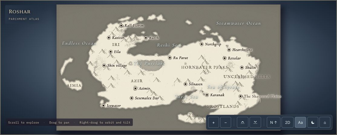
Roshar’s overview includes interpreted cities, coastlines, mountains and regions. The separate Shattered Plains map focuses on the fractured plateau landscape, warcamps and market. Later-book places have their own controls, so check the spoiler note before exploring.
- Open Roshar
The wider setting
Roshar map
Begin with the continent, its named regions and cities, including Kharbranth and Kholinar.
- Open The Shattered Plains
A closer view
The Shattered Plains map
Explore the plateau landscape, ten warcamps and market from above.
A route through the map
Use Roshar for the wider geography and the Shattered Plains for camp-scale detail. Zoom in before tilting toward the skyline. The cities’ buildings and streets are generated interpretations around authored landmarks, not measured city surveys.
Try these starting points:
Questions about this map
Is Roshar the map for The Stormlight Archive?
Yes. Roshar is the setting of Brandon Sanderson’s The Stormlight Archive. RuneCharted offers an interactive continent overview and a closer Shattered Plains map, starting with The Way of Kings setting.
How do I open the Shattered Plains map?
Choose The Shattered Plains in the viewer’s map tabs, or use its Open button above. The separate scene focuses on the plateau landscape, ten Alethi warcamps and market. You can return to Roshar at any time using the tabs.
Is the Roshar map spoiler-free?
Not completely. Major later-book places start hidden and require a choice to reveal them. Some geography from later maps is already visible and noted on its location card. Place names can still be spoilers, so read the spoiler notes before opening the atlas.
Geography and artistic interpretation
Published Roshar and Shattered Plains maps by Isaac Stewart inform geographic relationships. Warcamp positions and the major plateau composition follow those references, while small fractures, building counts, shelter layouts and character staging are interpreted. Some geographic positions come from later-book maps and are noted in location cards.
Read this map’s source and interpretation notes. The research notes may discuss later-book geography.
Before you explore: spoilers
The default view hides major later-book places until you choose to reveal them. A separate later-book scene is available through the map’s reveal dialog. Some minor later-map geography is already visible and labelled in its location card. This is not a promise that every name or geographic feature is spoiler-free.