The Westlands · The Eye of the World setting
Wheel of Time map: the Westlands in 3D
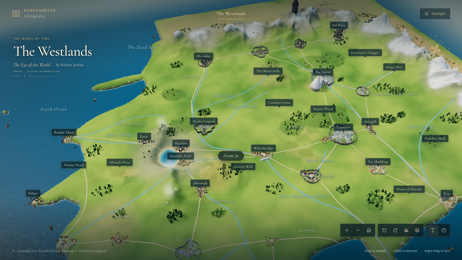
This Wheel of Time map starts from the Westlands map printed in The Eye of the World by Robert Jordan, then opens into an interactive 3D Westlands: the Two Rivers and Emond’s Field, Baerlon, Shadar Logoth, white Caemlyn, the island city of Tar Valon under Dragonmount, Fal Dara in the Borderlands and the Eye of the World itself. It is safe for readers of book one only.
In this atlas
What you can explore
The Westlands map shows the western continent as the first book draws it: the Two Rivers and the Mountains of Mist in the far west, the rivers Arinelle and Erinin running south, Andor and Cairhien in the middle, Tar Valon on its island, the Borderlands under the Mountains of Dhoom in the north, the Blight beyond them, the Aiel Waste and the Spine of the World in the east, and the coasts of the Aryth Ocean and the Sea of Storms. Cities, rivers, ranges, forests and roads follow the printed plate; the Eye of the World, which the plate does not mark, is placed in the Blight as an estimate. Places and events from later books are left out, though the plate names regions a first-time reader has not yet visited.
- Open The Westlands
The wider setting
The Westlands map
The printed Westlands map with its coasts, island groups, fourteen rivers, roads, ranges, forests, the Blight and the Aiel Waste traced, and the hero places built at map scale: Emond’s Field, Baerlon, Caemlyn, Tar Valon with its White Tower and six bridges, Fal Dara, Shadar Logoth and the Eye of the World.
A route through the map
Zoom all the way out to see the printed map unchanged. Move closer to reveal the terrain, forests and towns. The map is north-up, as the book prints it. Select a place to fly there; night mode lights the towns, the white cities, the Borderland torches and the pool at the Eye.
Try these starting points:
- Emond’s Field
- The Green
- The Winespring Inn
- Watch Hill
- Taren Ferry
- Deven Ride
- The Quarry Road
- The Two Rivers
- Baerlon
- The Stag and Lion
- The iron mines of Baerlon
- The ruined palace
- The walls of Shadar Logoth
- The river landing on the Arinelle
- The Royal Palace
- The Inner City
- The New City
- The Queen’s Blessing
- The White Tower
- The Shining Walls
- Northharbor
- Southharbor
- The keep of Fal Dara
- The walls of Fal Dara
- Whitebridge
- Caemlyn
- Tar Valon
- Dragonmount
- Fal Dara
- Fal Moran
- Shadar Logoth
- Cairhien
- The Blight
- The Eye of the World
- The Mountains of Mist
- The Aiel Waste
- The Spine of the World
- Tanchico
- Tear
Questions about this map
Is this a Wheel of Time map?
Yes. It is an interactive map of the Westlands, the setting of Robert Jordan’s The Wheel of Time, built for readers of the first book, The Eye of the World. It opens as the Westlands map printed in the book and then becomes a 3D world as you zoom in.
Where is Emond’s Field on the Westlands map?
Emond’s Field lies in the Two Rivers, in the far west of the Westlands near the Mountains of Mist. The atlas places it from the published map and zooming in shows the village, Watch Hill, Deven Ride and Taren Ferry.
Which places from The Eye of the World can I explore?
Emond’s Field and the Two Rivers, Baerlon, Shadar Logoth, Whitebridge, Caemlyn, Tar Valon, Fal Dara and Fal Moran in Shienar, the Borderlands, the Blight and the Eye of the World itself.
Does the map spoil later Wheel of Time books?
It is built to be safe for readers who have finished only The Eye of the World. Places and events from later books are left out, though the published map names regions you have not yet visited in the story.
Is this the official Wheel of Time map?
The first map follows the Westlands map published with the book, traced to its geography. The 3D terrain, towns and city layouts are RuneCharted’s own fan interpretation, and the project is not affiliated with Robert Jordan’s estate or the publisher.
Geography and artistic interpretation
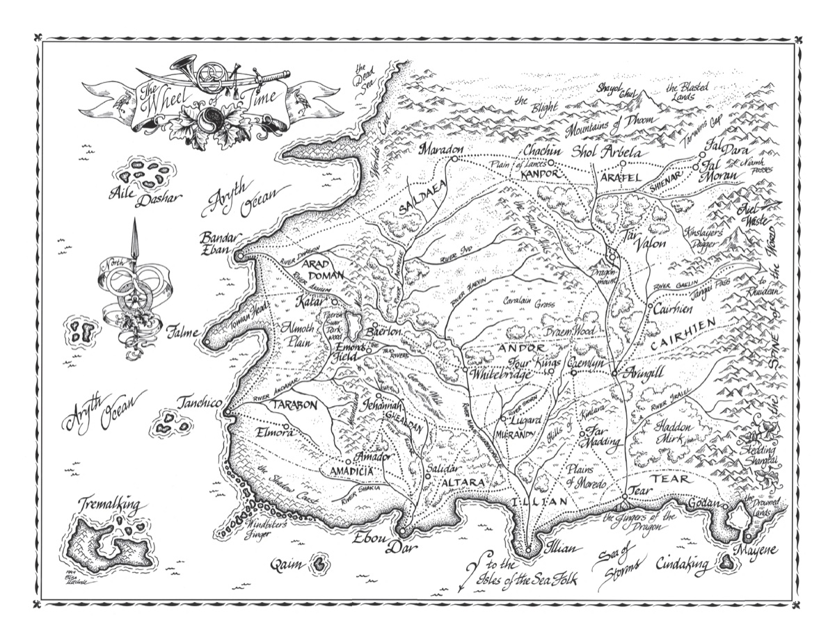
The first map follows the Westlands map published with the book, traced to its geography. Further maps from the Prophecies of the Dragon sourcebook and Ellisa Mitchell’s city plans are registered onto it as layers where the plate has no detail. The 3D terrain, towns and city layouts are RuneCharted’s own fan interpretation, not an official or licensed map, and the project is not affiliated with Robert Jordan’s estate or the publisher.
- Wheel of Time Wiki: the Westlands map by Ellisa Mitchell (fan wiki, corroboration only)
- Wheel of Time Wiki: Tar Valon city plan by Ellisa Mitchell
- Wheel of Time Wiki: the Two Rivers map


Read this map’s source and interpretation notes. The research notes may discuss later-book geography.
Before you explore: spoilers
Places stand as The Eye of the World shows them. Places and events first met in later books are not shown. Place cards paraphrase the book with chapter references and quote nothing; read the source notes for how each place was researched.