Middle-earth · The Lord of the Rings
Lord of the Rings map of Middle-earth
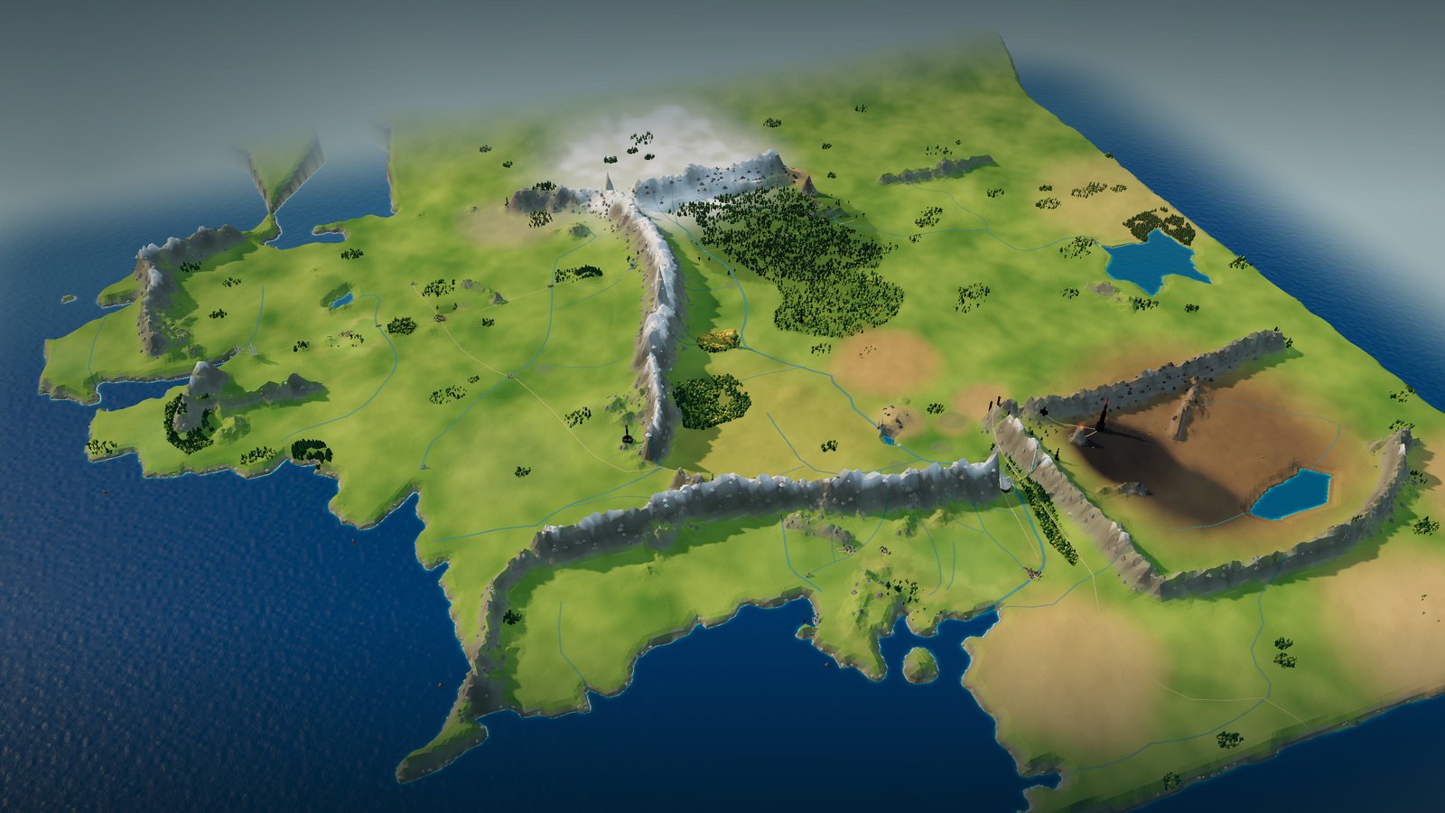
Start with Christopher Tolkien's general map of the West of Middle-earth, then zoom into an interactive 3D landscape: the Shire's fields, the Misty Mountains, Rohan's grassland, the white city of Minas Tirith and the ash plains of Mordor.
In this atlas
What you can explore
The world covers the whole general map: Lindon and the Grey Havens, Eriador with the Shire, Bree and the ruins of Arnor, Rivendell and Moria, Lothlórien and Mirkwood, Rohan, Gondor and Mordor. Every legible name on the map is selectable, from rivers and roads to fords and ruins; the larger Rohan, Gondor and Mordor map adds Dunharrow, the beacon hills and the fens of Rohan, the original general map adds Michel Delving and Buckland, and a few places named only in the text (Bywater, Caradhras, Amon Hen, Orthanc) are placed beside their mapped neighbours.
- Open Middle-earth
The wider setting
Middle-earth map
The published general map, traced coasts, rivers and ranges, Mirkwood and Lórien, and landmarks from Hobbiton to Barad-dûr.
A route through the map
Zoom all the way out to see the published map unchanged. Move closer to reveal the terrain, forests and buildings. The map is north-up. Select a place to fly there; night mode lights the towns, Lórien and the beacon hills.
Try these starting points:
Questions about this map
Which Lord of the Rings map is this?
Christopher Tolkien's general map, The West of Middle-earth at the End of the Third Age: his 1980 redrawing of the map first drawn for the 1954 first edition, carried in later editions of The Lord of the Rings. It is shown unchanged at the widest view.
Where is Minas Tirith?
On the eastern end of the White Mountains, beside the Anduin, across from Osgiliath. Select it to fly to the seven white tiers; Mordor's Mountains of Shadow rise just east.
Is the Shire shown in detail?
The Shire appears on the world map with Hobbiton, the Brandywine Bridge and the East Road. The Shire’s villages are not yet shown in detail.
Are the buildings canon?
No. Positions follow the published maps; the shapes of Minas Tirith, Barad-dûr, Orthanc, Edoras and the other landmarks are original interpretations, not film designs.
Geography and artistic interpretation
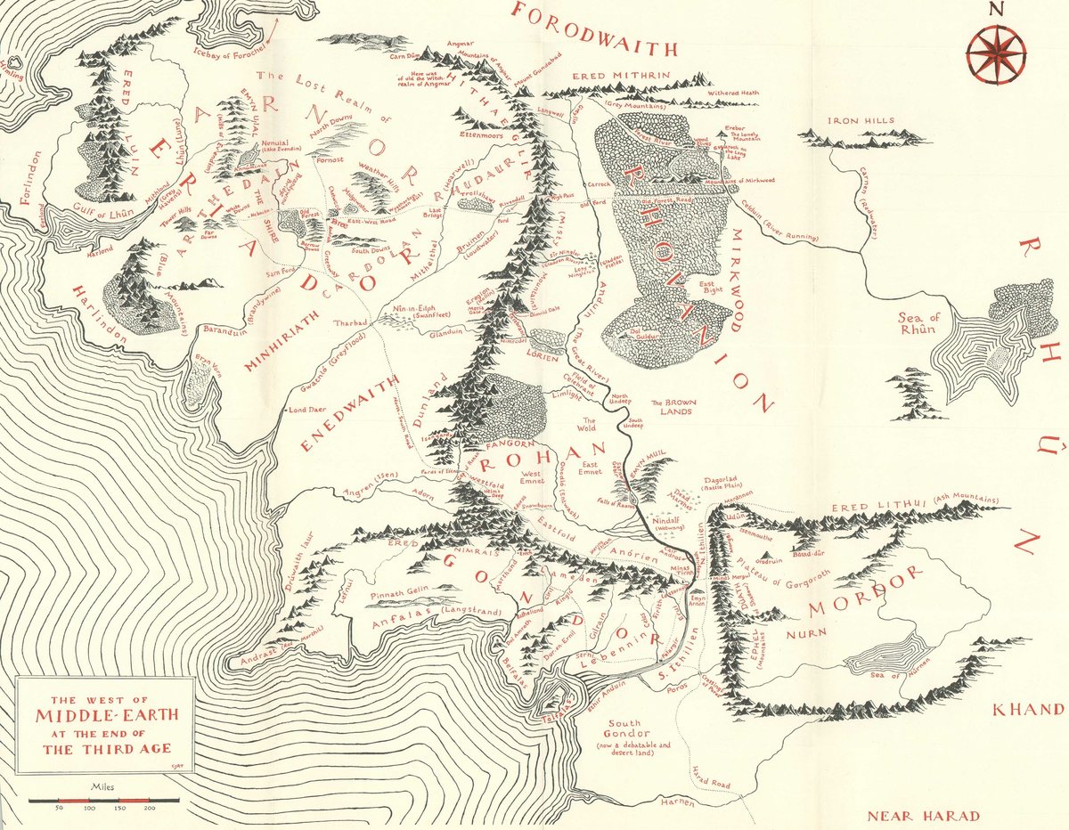
Three maps were used: Christopher Tolkien's redrawn general map (the template, shown at overview), his Rohan, Gondor and Mordor map, and the original 1953 general map. Positions follow the general map; building forms, heights, colours, town layouts and terrain heights are original interpretations sized to read at map scale.
- Curtis Wright Maps: the general map and Rohan, Gondor and Mordor, from a 1995 edition
- Curtis Wright Maps: the original general map, 1978 Houghton Mifflin reprint
Read this map’s source and interpretation notes. The research notes may discuss later-book geography.
Before you explore: spoilers
The map describes places as the story opens, without outcomes. Places come from the published maps, except a few named in the text that are marked as interpretation; there is no chapter-by-chapter filter.